Climate & Biomes Latitude & Topography Impacts


Climate & Biomes Objectives:
- Explain how sunlight distribution leads to varied ecosystems at different latitudes.
- Describe the impact of altitude and north vs. south-facing slopes on mountain habitats.
- Outline a climate and ecosystem tour from Newport on the Oregon Coast, over the Coastal Range, through the valley, over the Cascades Mountains, and into Eastern Oregon, including rainshadows along the route.
Biomes are ecosystems on a grander scale. For example, Lake Michigan in North America is a freshwater ecosystem, and lakes Michigan, Huron, Erie, Superior, and Ontario together are the Great Lakes biome. Both biome and ecosystem refer to a habitat’s environmental conditions and organisms. In this section, we’ll see how various physical factors impact life on land.
We are starting by defining biomes and how they relate to ecosystems.

Climate differences on Earth’s surface lead to widely different terrestrial biomes: polar regions, tundra, forests, grasslands, and deserts.
Climate is impacted by the amount of direct sunlight and the presence of mountains. We’ll start with sunlight.
Sunlight, Latitudes, & Climate
This video introduces the impact of sun on biome distribution along latitudes.
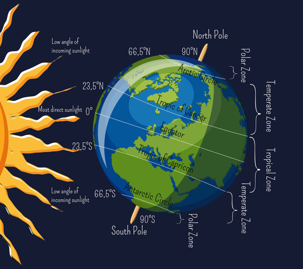
Sunlight hits the Earth’s surface more directly at the equator. That means in a given area, there is more sunlight hitting the Earth (and ocean) at the equator than the polar regions.


This creates different temperature zones: tropical as the equator, temperate north and south of the equator, and polar far from the equator.
The warmth at the equator creates a continual cycle of evaporation and precipitation. Wind currents that move north and south of the equator cause drier zones approximately 30 degrees north and south. The currents pick up enough moisture to support cold coniferous forests (Boreal taiga) around 60 degrees north latitude.
Can you explain in your own words why there are different biomes at different latitudes?

This video contrasts the impact of latitudes with the “real” distribution of biomes.
Topography & Climate
This video describes how a single mountain can have varied climates.

Mountains impact climate, an increase in altitude (height) is similar in moving higher in latitude away from the equator.
Mountains can also have different climates on the north and south-facing slopes as well as the east and west-facing coasts.

This video describes why temperature and moisture can be different on south-facing and north-facing slopes of hills and mountains.

Mountains, valleys, and the ocean impact biome patterns in Oregon. The dramatic range of biome patterns results in many different ecoregions.
When you look at a physical map of Oregon, it is clear that there are a variety of terrestrial ecosystems: green forests to sandy deserts.
It is also apparent that these ecosystems are not running along horizontal latitude lines: mountains are having a significant impact on climate and vegetation.
This video provides an overview of the rainshadow effect, explaining why Corvallis is generally drier in the summers than Newport along the coast.

Moist and relatively warm air coming off the ocean heads up a mountain. These air currents typically run west to east. As the moist air cools, rain precipitates out on the west-facing side of the mountain. This leaves drier air heading to the east-facing side of the mountain, creating a rainshadow effect on the east side.
Oregon has two large mountain ranges, creating two large rainshadows. This video tour through them.
We have two large mountain ranges in Oregon: the Coastal Range and the Cascades.
Which numbers indicate the location of rainshadows created by these mountain ranges?
Answer: 2 & 4

We are taking a trip across Oregon, starting in Newport Oregon along the Pacific Coast, and then heading east across the Coastal and Cascade mountain ranges.
You may be aware that coastal communities like Newport are often moist and mild. Why?

Along the Oregon coast, the high moisture keeps temperature relatively constant, with less extreme hot and cold temperatures than other locations at similar latitude.
The mountains rise very close to the ocean, forcing air to rise, cool, and precipitate out fog and rain. Many people escape the dry heat of the Willamette Valley by driving to the coast.
The west-facing slope of the coastal range is largely temperate rainforest, moist and cool enough to support moss, ferns, and trees like Sitka Spruce.
Although we are focusing on terrestrial ecosystems here, there are several rivers flowing to the ocean.


The tallest point of the Coastal Range is Mary’s Peak at 4097 feet. It has a meadow at the peak and trails for hiking. It can have snow for months, and since it is a close drive from Corvallis, many people get a snow pass and visit the peak in the winter months.

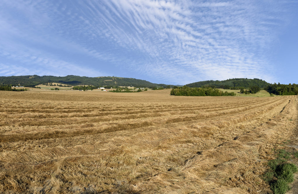
The Willamette Valley is in the rainshadow of the Coastal Range, and even though the winters are wet, the summers can be quite dry. Historically, the valley was oak prairie, wetlands, and coniferous forest. Now, much of the land is converted for agricultural, commercial, and residential use.

Dry summers with cool nights are not optimal for many crops. Two of the primary land uses are growing Christmas trees and grass seed.


The west-facing slope of the Cascade Mountains has more moisture than the Willamette Valley as the air is rising, cooling, and precipitating. There are matches of temperate rainforest, including Cascadia State Park and Silver Falls..
Extensive forests of Douglas Fir and Hemlock are supported by the available moisture.
This video shows water vapor condensing on the west slopes of the Cascade mountains, right off of route 20. The cloud movement reminded us of a pinching hand.

At higher elevations, temperature and moisture drop, and the dominant trees are Ponderosa Pines with their thick puzzle-piece bark.
Above tree-line where moisture and temperature drops significantly, meadows of low-lying plants replace the trees.

Eastern Oregon is a high desert, high because it is at elevation and can be cold, and a desert due to the rainshadow created by the Cascade Mountains.
Vegetation includes shrubs, grasses, and wildflowers. Some areas are so dry, vegetation is sparse; crops and livestock are supported by irrigation.

This is the end of Guide 2A. The next step is to take the quiz on Canvas and upload your Notes Media Piece.

Check your knowledge. Can you:
- Explain how sunlight distribution leads to varied ecosystems at different latitudes?
- Describe the impact of altitude and north vs. south-facing slopes on mountain habitats?
- Outline a climate and ecosystem tour from Newport on the Oregon Coast, over the Coastal Range, through the valley, over the Cascades Mountains, and into Eastern Oregon, including rainshadows along the route?


